Urbanize Green Spaces
for the Masses
This post is divided into various parts that include
traditional Neighborhood Parks Playlots & Gardens, Garden Walks, Doggie Parks, People Spots, and finally Greenspaceways
that are located along street cafes.
I begin with a video ...
This WTTW video highlights how Chicago neighborhood parks were the answer for urban dwellers.
A landscape architect Frederick Law Olmsted believed that public parks could
serve as meeting grounds for people of different backgrounds and economic means
that could be played out in a diversity of ways.
Urban Parks
'Urban parks are typically open, public places that can
hold many people at once. These features have led them to be put to use as
formal and informal gathering spaces, for civic or community events, and for
planned or spontaneous events. Parks have even been put to unexpected dramatic
use in times of crisis as a place for people to gather and for authorities to
provide services to those in need.' -
Urban Parks in the United States much like the Wendt Playlot on Roscoe Street. The below is from the Lake View Patch.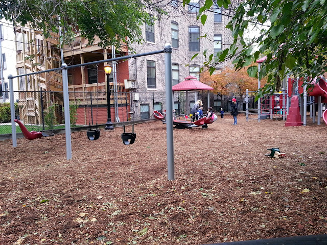
from the Chicago Park District
images - Chicago Park District history section
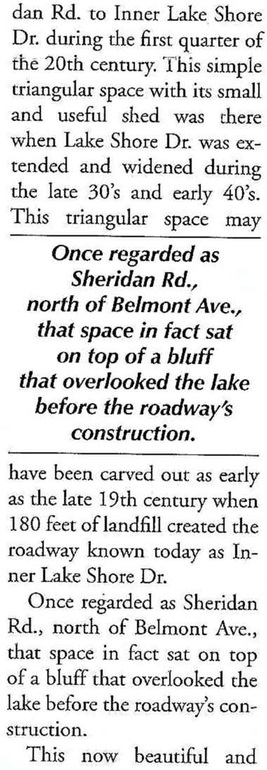
'In the early 1850's, a park movement emerged in Chicago, when visionary citizens began to rally for the creation of
the nation's first comprehensive park and boulevard system. A physician, Dr.
John Rauch led a successful protest to set aside a 60-acre section of a public
cemetery as parkland, marking the beginnings of Lincoln
Park. This
inspired citizens to press for three separate acts of state legislation
establishing the Lincoln, South, and West Park Commissions in 1869. Although
the three park commissions operated independently, the overall goal was to create
a unified ribbon of green that would encircle Chicago.' - Chicago Park District


The Parks & Gardens
of the Lake View Area:
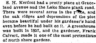
Kerfoot Park
once located along the then existing lakefront in the general area
of Sheridan Road/Irving Park Road - an apparent 225 acres
photo and text via Constructing Chicago
by Daniel M. Bluestone
'When Chicago was the Garden City' - 1901 Chicago Daily News
half of stereotype image - Calumet 412
of his garden-like property
just north of the Lake View House
(a link to my aother posting)
By 1870, one year after the creation of the Lincoln Board of Commisioners the park was located both in the City of Chicago and the Township of Lake View-north of Fullerton Avenue
'Band Concert Lincoln Park Chicago'
image - New York Public Library
Green Spaces
of All Kinds:
An urban public park in the City of Chicago was located at
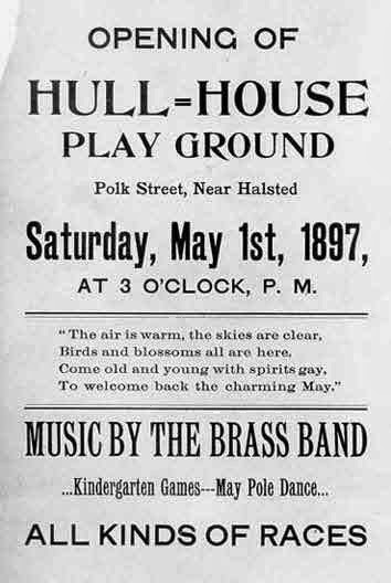
Hull House on South Halsted Street in 1897.
 1908 Residents of the District of Lake View
Petition for Park-land in 1908
Working class citizens demanded 'open space' during this time period that was closer to their homes other than the lakefront.
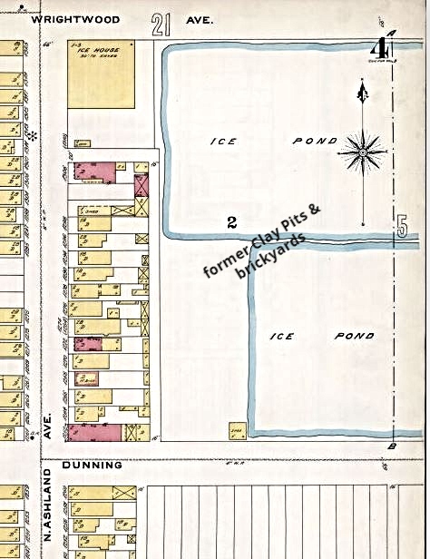
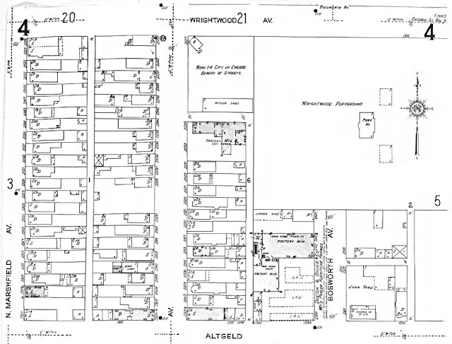
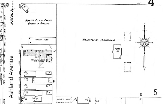
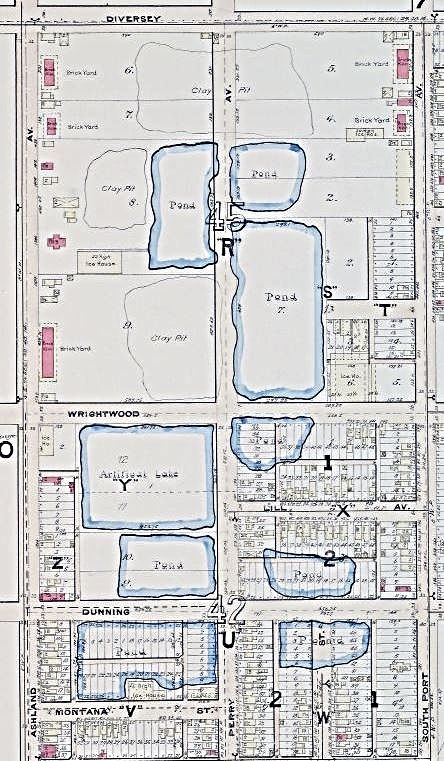
In 1907 Wrightwood Park, located in the relative newly formed District of Lake View, was created from an former clay pit and brickyards turned ice ponds as the Sanborn Maps show below. A number of pits were located mostly south of Diversey and west towards the Chicago River.
1894 Sanborn Fire Insurance Map of the Ice Ponds
1923 Sanborn Fire Insurance Map of the park spacezoomed view from map abovea view of the general area in 1887 from Diversey to Montana
Township/City of Lake View
images for their Facebook pageSanborn Fire Insurance Maps 1887
1922 cartoon called 'Their Playground'
image - National Archives and Records Administration
images - Chicago Park District 1937 Owner Donation of Property
for a Playlot
at 4246 N Hermitage
1940 New Playlots
in Lake View at
3505 N Clark
3600 N Clark
1239 W Melrose
1945 Police lead Organizations
for Several Playlots
'Central Park'
within Lake View
The Sisters of Good Shepherd Property
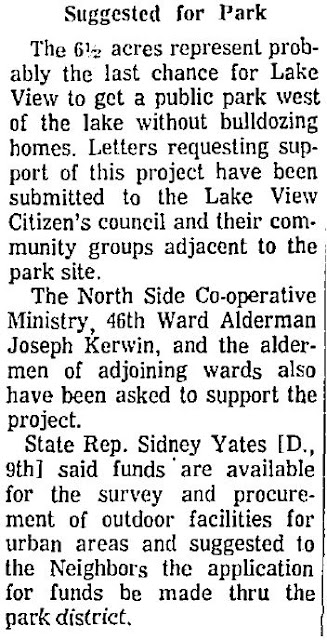
We could have had a couple acres of park at one time!
(click on the Luna link)

A Study
for this Possible Park in 1966
From a Coal Yard
to a park space
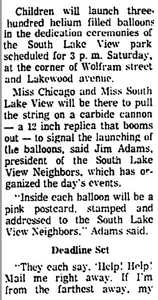
called South Lake View Park in 1969
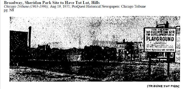
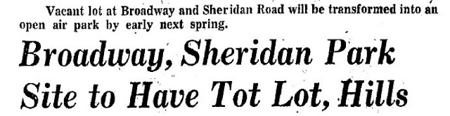
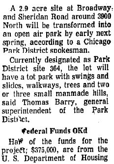
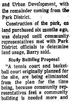
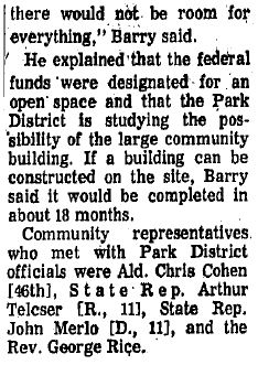
A New Park in 1971 at
Sheridan Road & Broadway
to be called Joseph Gill Park
The City Public Parks
in Lake View
as of 2014
These following park spaces are classified as parkgrounds
with a size of 5 to 25 acres in size
2018 Google Map View of Parks/Playlots
in the Area
Lake View Parks
by Name:
1300 W Wolfram Street
referred by the kids as 'Blue Park'
photo - Chicago Park District
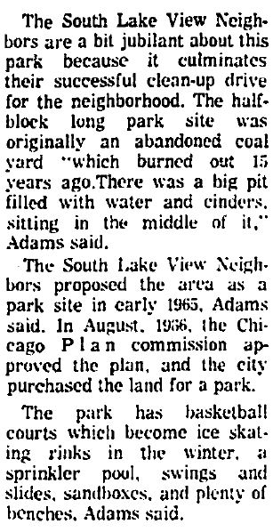
'In the mid-1960's, the South Lake View Neighbors
Association began to push for a playground in their crowded community. In 1966,
the Chicago Park District agreed to create a new park at the corner of N Lakewood Avenue and W Wolfram Street. Using both city Park Improvement Bond
funds & U.S. Department of Housing and Urban Development Grant Funds, the
park district purchased the property two years later. Before long, the new park
was equipped with basketball and volleyball courts, playground apparatus, a
sand box, and a spray pool. In 1969, the park district recognized residents'
efforts by naming the site South Lake View Park. Subsequent improvements include
a 1993 playground rehabilitation.'
As of 2018 the patrons of the park were looking for private funds to renovated this less than an acre space. - Chicago Park District
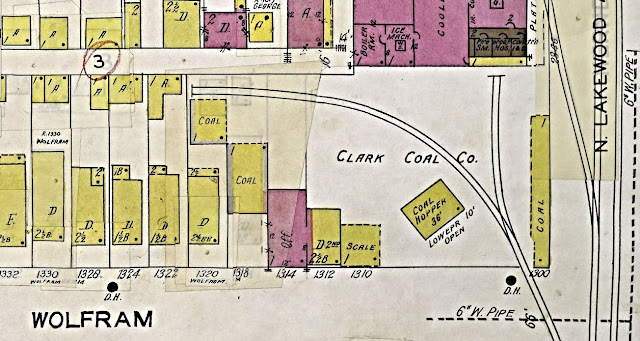
What the area look like in 1950
Sanborn Fire Insurance Map
Once located along the Evanston Branch
of the Chicago, Milwaukee, St. Paul railroad
Always was a Coal Yard
1887 Sanborn Fire Insurance Map
X marks the spot
1891 Sanborn Fire Insurance Map
zoomed view below
1894 Sanborn Fire Insurance Map
825 W Sheridan Road
photo - Erica C. via Yelp'Gill Park honors Lake View resident Joseph L. Gill (1886-1972), a Chicago Park District Commissioner, and local Democratic party leader. Gill served as 46th Ward Democratic Committeeman for more than 60 years. He was chairman of the Democratic County Central Committee from 1950 to 1953, and is said to have engineered Richard J. Daley's first nomination for mayor in 1955. Gill served the public in various capacities, including as controller of the Forest Preserve District beginning in 1919, as Illinois state representative from 1926 to 1930, and as clerk of the Municipal Court for most of the subsequent three decades. In 1960, Mayor Daley appointed Gill to the Chicago Park District Board of Commissioners. Gill was serving as park district vice president at the time of his death in 1972. Two years before, the park district had decided to establish a recreational facility on West Sheridan Road in the densely-populated Lake View neighborhood. By 1972, the site had been acquired with the help of funding from the U.S. Department of Housing and Urban Development, and plans had been developed for a multi-story field-house with a swimming pool, a gymnasium, and an assembly hall. Neighbors refer to the impressive structure as the "high-rise field-house." The park district installed a new soft surface playground at Gill Park in 1991'.
- Chicago Park District
The park was once surrounded one of last SRO's in Lake View called the Chateau Hotel.
Plans in 1970


entrance to indoor facilities on Sheridan Roadphoto - Gill Park Basketballoutside park area
2012 photo - Adriane P. via Yelpphoto - Kieth H. via Yelp 2013 Gill Park succeed in getting a face lift due to the sale and renovation of the Chateau Hotel as of 2014 What the area look liked in 1950
Sanborn Fire Insurance Map
The area was known for Chateau Theater located on Grace Street and Chateau Hotel on Broadway south of Sheridan Road
along with Chateau Apartments just west of the hotel
zoomed below
3505 N Southport Avenue
photo - Google Maps
'Sheil Community Center honors the memory of Archbishop Bernard J. Sheil (1886-1969), pastor at Lake View's St. Andrew's Catholic Church for more than three decades. A supporter of ecumenical efforts and of the rights of racial minorities and laborers, Archbishop Sheil was often referred to as "the friend of the little guy." His interest in young people led him to found the Catholic Youth Organization in 1930. The Sheil Community Center is located in the heavily-populated Lake View neighborhood, on land once occupied by the Hanson Laundry Company. The Chicago Park District purchased the property in 1973, demolishing the laundry plant. In 1975 the park district broke ground for a field-house with a gymnasium, a craft-shop, & club rooms.' - Chicago Park District
What the area look like in 1950
Sanborn Fire Insurance Map
once commerical property
since at least 1920
3538 N Lincoln Avenue
photo - Pinterest
'Lois Klein Park was created by the Chicago Park District in 2010 after several years of planning and land acquisition. Designed by the Hitchcock Design Group, the park has a whimsical playground. In 2011, the Chicago Park District’s Board of Commissioners named the park in honor of Lois Klein, a neighborhood activist who inspired members of the Lake View community in the 1980's and 1990's. Born and raised in Chicago Lois Klein (1931-1997) lived for over 30 years just two blocks from the site that now bears her name. During her life, she made many positive contributions to her neighborhood by participating in community meetings and volunteering for the local alderman’s office.

However, the bulk of her energy was focused on helping children. For many years she volunteered at two local schools, John J. Audubon Elementary School and St. Andrew School. Ms. Klein’s concern about neighborhood children prompted her to advocate for safety improvements to address the dangerous intersection at Lincoln Avenue Addison Street, and Ravenswood Avenue. She rallied the community to petition for improvements at the intersection. Ironically, in 1997, Lois Klein was struck by a car at that very intersection. Due to Ms. Klein’s tragic death, the intersection was soon modernized and made safer for pedestrians.'
- Chicago Park District
What the area look like in 1950
Sanborn Fire Insurance Map
1230 W School Street
once referred to as School Street Park
The design for Margaret Donahue Park in 2013
photos - Red Tricyle
'The Chicago Park District has worked closely with the School Street Advisory Council, Alderman Thomas M. Tunney and the Chicago Cubs on the development of a new park in the Lakeview community. The $1.2 million park includes a major playground installation. The advisory council formally requested that the new park be named in honor of Margaret Donahue (1892 – 1978), one of the first women executives in major league baseball. The Chicago Park District Board of Commissioners complied with the request, and the park was officially named in 2014. Born on a farm in Huntley, Illinois, she moved to Chicago at the age of 16 to find a job as a secretary. In 1919, with only one year of high school a year of secretarial training, and a brief position at a laundry, Donahue was hired as a stenographer by William Veeck, President of the Chicago Cubs (and father of longtime Cubs owner Bill Veeck). At the time, the only other woman who worked for the Cubs was the team’s bookkeeper. That woman soon left, and Donahue took over, performing as both secretary and bookkeeper. She quickly took over many responsibilities including ticket sales, stock transfers, providing press passes, and handling gate receipts for other Wrigley Field events such as Chicago Bears professional football games. Before long, she was traveling with the Cubs. In 1926, Veeck promoted Donahue to corporate secretary, an unprecedented role for a woman in the major leagues at that time. She brought many innovations to professional baseball such as season tickets, providing off-site ticket locations, and selling reduced priced tickets for children. When Donahue was promoted to vice president of the Chicago Cubs in 1950, she was the first woman in this role in the major league to have come up through the ranks. Donahue retired in 1958, prompting Phillip K. Wrigley to issue a proclamation describing her as a “nationally acknowledged authority on the intricacies of baseball rules and regulations.” When Donahue died in 1978, she was eulogized by Jack Brickhouse on WGN.' - Chicago Park District
photo - Chris Gent Landscaping Studio
Margaret Donahue Park - 2015 photos
What the area look like in 1950
Sanborn Fire Insurance Map
once a space for an auto spring factory along the former Evanston branch of the Chicago, Milwaukee, St. Paul railroad
These following public green spaces are classified as playlots that average between 0.5 to 1.5 acres in size.
Playlots are administered by a park supervisor of
an existing nearest neighborhood park. Some were property lots that may have had a some sort of building on it at one time much like Wendt Playlot on Roscoe Street.
Pines Kiddie Playlot
decommissioned
once located on Pine Grove and Brompton Place
with some articles from 1949
article #2

The List of Playlots
as of 2017
1938 - Hermitage Avenue Park (same as Helen Zatterberg)
Wendt Playlot Rehab
& Re-dedication in 2013
667 W Roscoe Street
2009 Google View of the lot space
A sample of a playlot's renewal and re-dedication
This playlot earned the approval of the city park district in 2012 to renovate the space as well as a re-dedication that following year. The first dedication was in 1991. I was board member of the Belmont Neighborhood Association the assisted in the planting of the space and part of its re-dedication in 2013.
the old stuff is gone & waiting for the new equipment
Design Plans
The design plan was chosen
by the neighborhood association of the area
new equipment and new cement in place
The 'suits' were there!

Vintage Views of the Original Lot
Photos below are vintage playlot photos
when it was just a near vacant lot with a swing
photos 1980's - George GEO
"Back in the late 80's when the park was first converted from a run down empty space to the new and improved version, there was a party and dedication to celebrate... there was an effort made by the Wendt family to have the park named in his honor and they did some fund raising (as I remember) to cover expenses of the conversion that was not covered by the Park District (like the front gate and fence, among other items)... his wife and daughters that survived him spoke at the dedication." - testimonial from 'GEO' 2014
A Mural in 2022
photo below via Carina Sawaya 2022
Space Park
on Roscoe
photos via Triangle Neighbors Association
a pamphlet for the new park


 and The Final Product ...


other photos - their website & Facebook
The Lake View High
School's Park Space
4015 N Ashland Avenue
a community shared park space
within the property of the school

photo - Chicago Historical Schools
'Campus park dedicated October, 1997. The 2.3-acre park includes a running track, playground, open field area for outdoor games, a multipurpose area for marching band rehearsals or ROTC drills, upgraded benches and trash receptacles, ornamental fencing and lighting, new trees, shrubs and perennial plants.' - LVHS
photos - Lake View High School
Hawthorne
Community Garden
within the Hawthorne Scholastic Academy property
as of 2019 with a blend of playground features their sponsors ....
 This park space was the creation of a community association called Hawthorne Neighbors and the Chicago Public Schools with the assistance of the 44th Ward of Chicago. Funds
 for this park space were from private sources.above is a Google Map view of the school's property with an X that marks the spot. Below is a concept design map of the park space along with text from the projects website. within the gates of Blaine School along Southport
the space within the gates
the design renditions
the space within the gates
prepping and planting
all photos - Lake View Patch
property owned by the CTA
My favorite garden
with a historical story along with it
 photos from their website
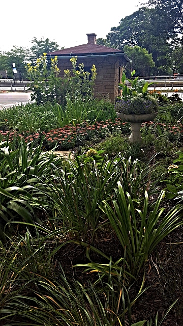
'About six years ago, Weinberg, a resident of 3800 N Lake
Shore Drive, started the nonprofit after she was given the keys to the 'shack' (a former public trans supervisor's station) by
a fellow resident of 3900 N. Lake Shore Drive. Inside the shack was, as Weinberg described it,
"floor-to-ceiling CTA junk, metal chairs and old-fashioned Christmas
bulbs. "Weinberg and a few hardworking volunteers, including a city police
officer and 46th Ward Alderman James Cappleman, cleaned out the shack and started
planting perennials, trees and shrubs in the garden. Weinberg said the
nonprofit volunteers also hang up Christmas lights plus
change the decorations for Halloween and Spring.' - DNAinfo 2017
photos - Sheridan Triangle Garden
Me and the shack prepping for the holiday season
2016 photo - Garry Albrecht
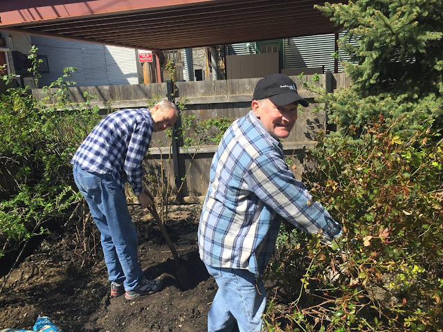
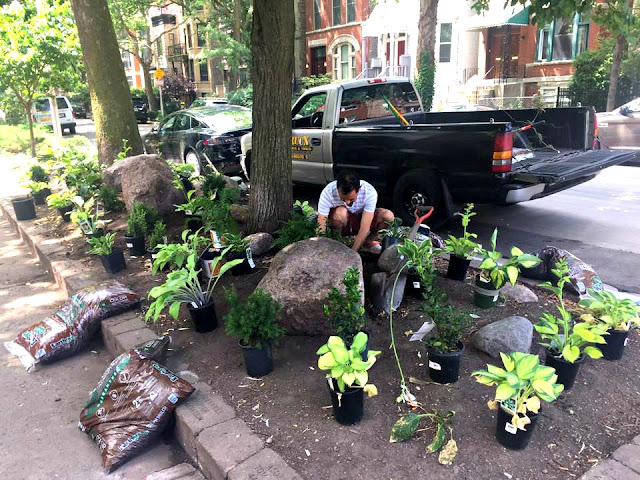
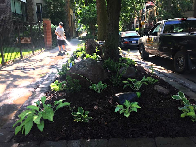
The Annual Spring Clearing & Cleaning in 2017
photos by me
a planning discussion by the shed
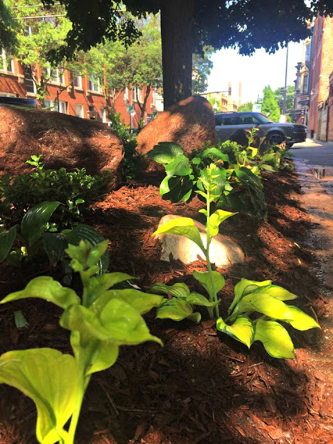
a new look for the garden below
replacing the tree for another design
photos - their website
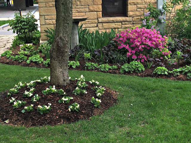
 photo - Jill Weinberg

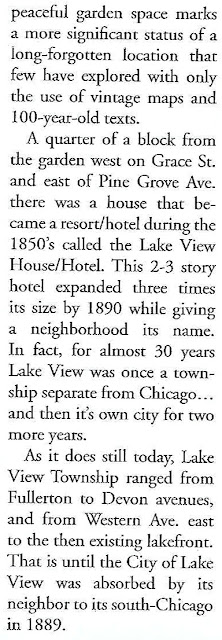
This Park has
Historical
Significance
A 1869 University of Chicago map of northern part of Pine
Grove (Lake View East) subdivision that shows the hotel
This area marks the area location of the Lake View Hotel - the hotel/resort that served as a meeting place for potential real estate investors and potential homeowners from 1854-1890ish. The Kerfoot Garden property mentioned in the beginning of this post was located just north of the Lake View Hotel. Mr. Kerfoot's garden space was apparently along Irving Park Road & Halsted Street near the existing shoreline of the lake.
edited map - Google Maps
Written by me
for a local historical association newsletter


The Park Spaces
Within a Park
within a Lincoln Park, the park:
along the Lakefront
into a Picnic Grove, Natural Area, and Artificial Turf Field
to help end constant flooding
via 44th Chicago Ward Officehigh land area in green; the low area in red
to be located in Lincoln Park at Barry & Lake Shore Drive and near the Belmont Harbor parking lot2018 Google Map view
The Mission Statement
'The mission of the AIDS Garden Chicago is to create and maintain a garden space for reflection and education about the AIDS epidemic. The 'Garden' honors those that have passed and those that have survived, and celebrates the heroes of the AIDS Epidemic and their ongoing work to eradicate HIV/AIDS. The AIDS Garden will be built along the Belmont Rocks, a space the gay community would gather at since the early days of Chicago's LGBT movement. The Rocks were about claiming the right to be, to exist, to gather outside and to be out of the shadows and the closet. The AIDS Garden seeks to help preserve that memory and to honor the history of HIV/AIDS in Chicago. It is fitting to create a garden in that Belmont Rocks space. Since the early days of gay movement, the Belmont Rocks were a place to call our own. The lakefront stretch of stone and grass from Belmont to Diversey harbors was a public space Chicago’s LGBTQ community claimed from the 1960's through the 1990's. This was more than a frequented area.
The Rocks were a political statement tied to our liberation, a symbol of our right to be here, our right to exist, and our right to gather outside and in the sunlight at a time when our bars still had blackened windows. [Our] community happened along this undesirable strip of uneven limestone blocks. Relationships and friendships happened here, hook-ups, unions, memorials, picnics, cookouts, dance parties, and rallies. Artwork covered many of these stones. At the Rocks, people lay in the sun, watched the sunset before going out, and sat to watch the sunrise after the bars closed. In 2003 the Belmont Rocks were bulldozed and removed as part of a revetment project to safeguard against shoreline erosion. The Rocks themselves may be gone, but this portion of the Chicago shoreline will forever remain a place of celebration, joy, and remembrance in the pre-AIDS era and the throughout darkest days of the epidemic.' - Aids Garden website
2018 photo below via Tom Tunney, 44th aldermanThe Groundbreaking Ceremony 2021
On June 2, various local officials, including Chicago Mayor Lori Lightfoot, helped break ground at the AIDS Garden Chicago—the city's first public park to memorialize the early days of Chicago's HIV epidemic, and to honor those who continue to fight against the disease. The event took place in front of the garden's anchor piece, the 30-foot Sculpture. The 2.5-acre garden is situated on Lake Michigan at the original location of the historic Belmont Rocks, a space where the local gay community gathered between the 1960's and 1990's. The Chicago Parks Foundation is leading the garden's fundraising and community conversations. Established in 2013 as the nonprofit partner of Chicago's parks, the Chicago Parks Foundation operates in a public-private partnership with the Chicago Park District to provide fiscal partnership to foundations, organizations, and individuals who wish to support their parks.
construction views 2021
photos - Garry Albrecht
view from the south
and a view from the lakefront photo below
J Scott Sykora via Pictures of Chicago/ Facebook 2022
2845 inner Lake Shore Drive
established in 2017
photos - their Facebook page
2022 photos - 44th Ward Office1446 W Warner AvenueThis garden much like Sheridan Triangle Garden is supported by a neighborhood group in the Graceland West neighborhood of Lake View. In the late 1990’s, NeighborSpace, a non-profit organization devoted to creating community open spaces in Chicago, established a perennial garden in the then under-served area of the Lake View community. The organization named this 1.4 acre site the Warner Garden due to its location Warner Avenue. The Chicago Park District has a long-term lease with NeighborSpace for this property.
a new look by 2019
by Wrigley Field
a green space to gather

2017 photo - Southport Corridor News and Events
'Sitting in the heart of Wrigleyville, the Park at Wrigley
offers a beautiful open-air destination for farmers markets, community events,
festivals, dining and much more. The Park at Wrigley serves as Wrigleyville’s
town square
- a year-round gathering place for neighbors, families, fans and
visitors. There’s room to stretch out at the Park at Wrigley - with
a flexible space for festivals, concerts and neighborhood celebrations. Check
back often to see upcoming cultural celebrations, food and wine festivals,
concerts and more. Like Wrigleyville itself, the Park at Wrigley has something
for everyone.' - their website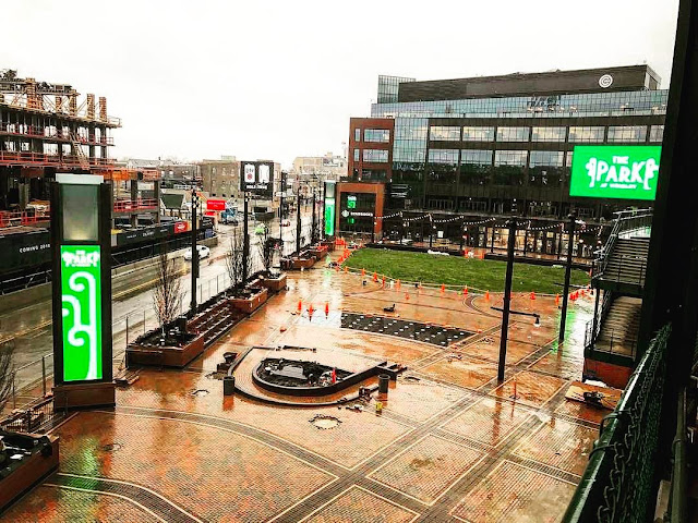
2017 photo - Southport Corridor News and Events
2017 photo below - CBSChicago
2019 photo below - Chris Cullen
Lake View's
'The contest was open to all outdoor floral displays
visible from the Northwestern tracks.
Five judges from the Industrial Club had been riding around in a special
train to inspect the entries. The
winners were announced on July 23, 1910. Northwestern did not skimp on the
prizes. First place in any of six
categories was worth $50, over $1200 in today’s money. Cash was awarded for backyard gardens, window
boxes, and porch displays.' - Chicago History Today
3649 N Sheffield1036 Roscoe StreetSt. Joseph Catholic Church School Garden Lake View Citizens Council
awards & prizes in 1958
Lake View Sponsors in 1960
Lake View's Community's
Last Garden Walk
To my knowledge the last successful one
Lake View Walk “We've listed all the garden walks we know of through mid-July. Missing is the Lake View Garden Walk. Last year it had nearly 100 gardens. This year? Who knows if it is even happening? The web site hasn't been updated and the group won't return messages.” - Gapers Block 2003
2012 photo - Peter Wasik
Garden Walks has had one continuous success in one neighborhood in Lake View called West Graceland located in an area of spatial houses and suburban-like property. The West Graceland residents began their 'walk' in 1972. According to the organizers having three gardens per block is the bare minimum.
Reason for Decline
According to the article posted by Garpers Block contributor, Patrick Boylan, “the reason not to have more neighborhood venues is the time of year. It's mid-summer, the gardens should be well watered from a continuing series of storms in late June and they should be at a glorious height of color. The issue in late June & also in mid-July is one of choice. There are far too many well established garden walks in other parts of the city and are all crowded in a few weeks and some of the largest take place at the same time each year."
The Last Remaining Garden Walk
The Graceland West
the only continuous annual 'walks'
in Lake View since 1982
2022 Garden Walk Map
the neighborhood of Graceland West a neighborhood association was established in 1979
according to their website
Google Map of Greenview & Cullom
The Greenscapes:
Illinois Masonic Hospital Complex
a wall of green
image - Google
three 2017 photos below - Garry Albrecht
 A Neighborhood
 Greenways:
San Francisco calls them parklets
This novel idea creates addition green space
for folks to just hang-out
photos - Lake View Patch
all photos - Lake View Roscoe Village Chamber of Commerce
A Post Note:
Cemeteries
mass green spaces to gather
for a picnic
'WITHIN THE IRON-WROUGHT WALLS OF American
cemeteries—beneath the shade of oak trees and tombs’ stoic penumbras—you could
say many people “rest in peace.” However, not so long ago, people of the
still-breathing sort gathered in graveyards to rest, and dine, in peace. During
the 19th century, and especially in its later years, snacking in cemeteries
happened across the United States. It wasn’t just apple-munching alongside the
winding avenues of graveyards. Since many municipalities still lacked proper
recreational areas, many people had full-blown picnics in their local
cemeteries. The tombstone-laden fields were the closest things, then, to
modern-day public parks.' - Altas Obsura
Follow me to my next post called
Important Note:
These posts are exclusively used for educational purposes. I do not wish to gain monetary profit from this blog nor should anyone else without permission for the original source - thanks!


 photos from their website


.jpg)


No comments:
Post a Comment