The Cemeteries
of Lake View Township
It was all about higher ground ...
If it was not for a mass placement of cemeteries in the
Township of Lake View old Lake View
may never have developed so quickly


It is my view that Lake View would have had a protracted development if it was not for the establishment of the cemeteries in the Township of Lake View in the early 1860's. With the failure of Chicago Cemetery in the City of Chicago the plan was to move the only cemetery on the northside to a higher and more drier elevation to any area with that welcomed the deceased. The Chicago Cemetery was located on the then sandy marshlands along Lake Michigan in an area we call Lincoln Park, the park.
This post is closely related to my other post called
The Lincoln Park Connection and
a online book called 'Lincoln Park 1899'
that is now part of my private collection

photo - Cragin Sping via Flickr

X marks the spots of the townships discussed
As the park - Lincoln Park expanded northward into the Lake View Township the finanical responsibility of park was to shared with the townships of Lake View and (North Chicago - location of Chicago Cemetery). The Assessors of these taxing entities would determine the proper property tax for the citizens of their respective areas. The Collectors of each township would collect the tax that the assessor determined fair to collect.

photo - garry albrecht
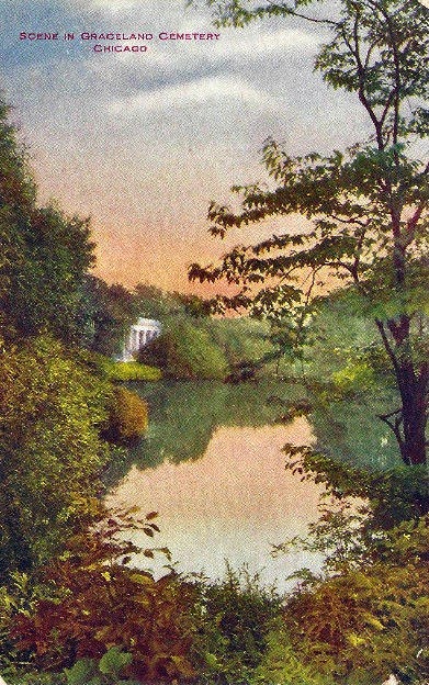
'Graves at Graceland'
Once upon a time Sundays were the day to visit the deceased relatives beyond the city border. The living relatives of the city traveled along Green Bay Road (Clark Street) to visit their deceased relatives. Green Bay Road had several cemeteries along its roadway. Roadhouses were built to serve the dirty, tired, and hungry travelers & their horses. These roadhouse for food & lodging would later become popular beer gardens/cafes in the last quarter of the 19th century & first quarter of the 20th century. One early roadhouse was the Sunnyside.

Subdivisions would develop not only along Green Bay Road but also Little Fort Road (Lincoln Avenue) and Evanston Avenue (Broadway); manufacturering companies along rivers and rail lines. More pioneers from Europe and the East Coast would become old Lake View home.
A Poetic View for Space of the Dead
from a book called Description & Dedication of Rosehill


photo - Graceland Cemetery - Chicago History Museum

from The Chicagoan

This Story Begins with ...

apparently the first origanized one

map - Chicago and Cook County Cemeteries
'And whereever people gather, deaths begin to occur and a
place for the dead need to be established. Fort Dearborn Cemetery can well be
considered Chicago’s first cemetery. Very little physical description of Fort
Cemetery is known, but we know the site
was not much more than sand [and marsh], which shifted with the winds off Lake Michigan. It
was difficult if not impossible to
maintain the graves against these elements. Markers at best were probably simple
wooden headboards or [small] crosses [or many rock placements]. Many graves probably went unmarked.'
and then shortly after ...
1837-1869
a lesson not learned from the Dearborn Cemetery


"Chicago’s early white settlers buried their dead alongthe banks of the Chicago River. The town's first two cemeteries were established in August 1835 and were located by the Lake Michigan shore, at the north and south boundaries of the city. The south side cemetery occupied land at 23rd Street. The north side cemetery occupied the grounds from Chicago Avenue, north to today’s Oak Street.


On March 2, 1837, as part of a large land grant, the
Federal Government gave the tract that includes today's Lincoln Park to the
State of Illinois. This occurred during an early phase of the construction of
the Illinois and Michigan Canal. Beginning in 1838, the State sold off portions
of the land to help pay for the Canal. In February 1837, the State Legislature
wrote an act that appointed part of the newly surveyed land to the Town of
Chicago for use as a graveyard. Chicago became incorporated as a city in May,
that same year. The acreage was not used for burial purposes until the
city paid for and thereby acquired the title for the land. In December 1842,
the Common Council passed an ordinance for such a purpose. In the interim,
during the Canal sales, three parcels of land within the cemetery's appointed
grounds were acquired by individuals, including Jacob Milliman, who would later
figure into the cemetery's history.
Burials in the new Chicago Cemetery began in 1843. On May 13, 1843, the Common Council passed an ordinance forbidding interments in the older burying grounds."

by Andreas Simon
page 107
"Prior to 1835 [the Town of Chicago] had no stated place for the interment of the dead. Up to that time the friends and relatives of the deceased buried them in some convenient spot near their homes Then as time passed the people living near the forks of the river had a common piece of ground where they buried their dead. The bodies from old Fort Dearborn mostly found a resting place north of the main river and east of the old dwelling in which John Kinzie [DuSable's old place] lived. Here too the latter was buried in 1828 but in 1835 his bones were disinterred and removed to the northside cemetery which was situated where today the north side pumping station is standing but even there they found no rest for in 1842 they were again taken up and transferred to the Lincoln Park Cemetery from where they were removed to their last resting place in Graceland In 1832. There was a small burying ground near the northwest corner of Wabash Avenue and Lake Street and there the soldiers who died of cholera in that year were interred. Quite a number of deceased persons were buried along the banks of both branches of the river and it frequently happened in later days that the workmen employed in excavating came across forgotten graves without being able to ascertain whose remains the moldering coffins contained [particularly after the Great Chicago Fire of 1871 and well in the mid to late 20th century).
In the summer of 1835 the official surveyor of the town [of Chicago] was commissioned to select and survey two pieces of ground that could be used for cemetery purposes one of the tracts situated in the south division of the city to contain sixteen acres the other which was to be established on the North Side to have an area of ten acres. These were the first regular cemeteries of Chicago and they were located as follows on the south side near what is today Twenty Third Street [near the] lakeshore [and] on the north side near Chicago Avenue and immediately west of the lakeshore.
As soon as these grounds were turned over to public use interments were prohibited elsewhere within the limits of the town. The South Side tract served as a burying ground until the year 1842 and five years later the bodies slumbering there were taken up by order of the city authorities and re-interred in the Lincoln Park Cemetery which in the meantime had been laid out and put to use This tract of which more details are given in the chapter relating to Lincoln Park contained three thousand one hundred and thirty six burial lots and was commonly known as the Milliman tract. Here also the remains interred in the old North Side cemetery near Chicago Avenue found their next resting place but in 1865 when the city council ordered the removal of this cemetery they and all the rest were again disinterred. The lot owners were authorized to select other lots of equal size in any of the newly founded cemeteries in exchange for the lots surrendered in the Lincoln Park tract. At that time, Rosehill Graceland and Oakwoods had been established and when the two years had expired within which the city had to clear the Milliman Tract of all the bodies buried there. The city council named the Aldermen Woodard Lawson and Wicker as a committee to make the selection for nearly two hundred lot owners who had failed to hand in their claims and whose whereabouts could not be ascertained, The bodies were divided among Graceland, Rosehill, Calvary, and Oakwoods. In the latter cemetery, the city held the title to the entire Section B-third division which had been purchased and upon the owners of all lots in this manner exchanged were conferred the privilege of obtaining a deed to the new lot."
The Chicago Cemetery
in the park, Lincoln Park
The mass establishment of cemeteries of the former township of Lake View would never have happen in the 19th century if it was not for a failure of the first northside cemetery within the City of Chicago. Constant and repetitive epidemics and the overwheleming fear of the root cause of these epidemics would by 1866 outlaw interments in the Chicago Cemetery and anywhere else within the city limits. This was the golden moment for townships that surrounded the city in particular Lake View.

map - 'The City on the Move'
by Michael Williams, Richard Cahan, & Bruce Moffat

a record sheet of morality rate in Chicago
"On May 13, 1843 , the Common Council passed an ordinance forbidding interments in the older burying grounds. From 1845 through 1849, in addition to selling lots and burying the dead in the newly-surveyed grounds of the Chicago City Cemetery Chicago Avenue to Oak Street. From 1850 through 1854, the cemetery expanded northward as the previously surveyed grounds were consumed by interments. In 1850, the city acquired Block 49, which had been part of Jacob Milliman's farm. In the 1860's, when the Supreme Court ruled the city acquired the lands illegally, the city was required to vacate the grounds and return the land to the Milliman heirs, thus began the first disinterment from the [Chicago] Cemetery.'


image - Hidden Truth
According to 'Intramural Interments in Populous Cities, and Their Influence Upon Health & Epidemics' by John H. Rauch, M.D. via 'Hidden Truths', “few or none (of the graves) are dug deeper than four feet without coming to water, and many still less, particularly in what is called the public part of the City cemetery.” Doctor Rauch continues to stated that “The drainage into the lake from every portion of these cemeteries will be appreciated from their proximity to it, and from the topography of the ground, and the sandy nature of the soil, resting as it does upon a stratum of clay impervious to water, so that when it rains the water percolates through the sand and the decomposing mass of animal matter until it comes to the clay, whence it is carried directly into the lake”.

image - University of Chicago Digital Map 1863 zoomed
highlighting all the cemeteries along the lakefront
Doctor Rauch findings were finally published in 1866 that began a movement of construction of cemeteries miles from lakefront and along a high elevated ridge along Green Bay Road (Clark Street) in the most rural area of Lake View Township. There was city-wide meeting about saving and improving the cemetery space in 1859 by Walter Newberry but by 1869 the old cemetery would be annexed into an existing park to the north called Lincoln Park that was formally established one month after President Lincoln's death in 1865 by the City of Chicago. Burials ended in 1866.

image - University of Illinois Digital Map 1868 zoomed
highlights the cemeteries south of a new park
Talk of Improvements in 1859

No More Burials
and a Transformation to Park Space

text - 'Lincoln Park 1899'

The Rebel (Civil War) graves were located southeast

along with 'rebel cemetery'
photos - Bob Russell, Forgotten Chicago-Facebook

Couch Tomb
1901 photo - Hidden Truths
only remaining symbol of the old city cemetery ...
 text - 'Lincoln Park 1899'
1901 photo - Hidden Truths
only remaining symbol of the old city cemetery ...

This 1903 map from Hidden Truths show bodies found


The Google Map below
indicates the area where the cemetery was located

red pointer marks the apparent spot
In the years 1850ish to 1857 there was a township called Ridgeville. Ridgeville Township was subdivided mostly into Evanston and Lake View townships in 1857. There was property for the dead that did not involve a church graveyard or someone's backyard. According to Chicago and Cook County Cemeteries this cemetery was "once located the northwest corner of Ridge and Greenleaf Avenues. A Henry Clarke bought eighty acres of land from the government on September 28, 1840. He and his wife, Lorinda were granted a land patent on March 10, 1843. Henry Clark deeded approx. one-half acre of this land to the township trustees on December 2 1846, for use as a cemetery and school, described
“for the quick and the dead.” The property is described on various documents as being of slightly different size. One document shows .55 acre, 22 rods (363′) by 4 rods (66′). Another document described the property as being forty chains (264′) by 1 chain ‑ 25 links (82.5′). When the city of Evanston was platted by 1853, the cemetery lot fell outside the Evanston City limits. A log school house and meeting house, used for school, social events, and for Sunday worship. was called the Grosse Point School house, and was built by Samuel Reed by 1842. It was believed to be located on the southeast corner of the property. The cemetery was on the rear (west end) of the lot, between Greenleaf and Lee Street. The First Methodist Episcopal Church began here, conducting services at the school house between 1846 and 1855. They shared the building with others including the Baptists and the Presbyterians. Historical accounts refer to parishioners visiting the cemetery after Sunday services to tend to the graves of their loved ones. Cemetery lots were sold for two dollars each. Each lot would contain space for ten graves. By 1890 most bodies were removed to another cemetery not specified in historical accounts. The cemetery had been in such poor condition that the City of Evanston prepared an ordinance declaring the cemetery a nuisance. It was stated that the cemetery had been neglected for many years. In 1900, workers found two skeletons from this cemetery while digging a sewer. By this time the cemeteries on the north-side were firmly within the City of Chicago.
The Township of Lake View
The Township/City of Lake View once had jurisdiction over a number of cemeteries between 1860 & 1889. After the failure of The Chicago Cemetery in the mid-19th century the high elevation in the old township was an ideal location to place a growing population of the departed – outside City of Chicago limits. According to my readings most of the township/city of Lake View remained rural north of Irving Park (Albert Street) during this time period with spotted arerove.as of urban developments that has long been forgotten such as Chittenden, HenryTown, and Pine Grove.
The Cemeteries
by 1862


Rosehill
and Bonifacius (Boniface) Cemeteries
(green patches)
 Graceland Cemetery north of Graceland (Irving Park Road)
and the German and Jewish Cemeteries south of Graceland

Cemeteries Listed
as of 1872


I do not have any information of 'Sons of Peace' cemetery
The Townhip
Cemeteries
in Maps:
1887 Rascher's Atlas Maps
St. Henry's
Catholic Cemetery
the only remaining
church cemetery in Chicago

Rosehill
Cemetery


sheet 46 eastern section
 zoomed below highlights the entrance, railway, and hothouses
 zoomed further below


with hothouse
for the purchase of fresh flowers

south section along Bowmville Road


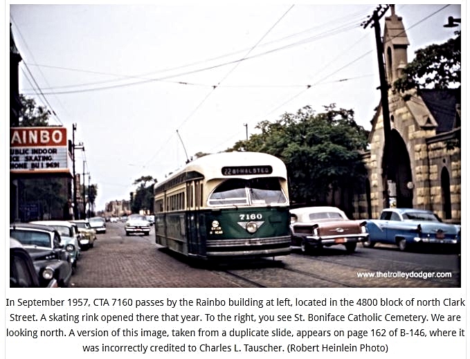
Bonifacius
(Boniface) Cemetery


Graceland
Cemetery

section along Clark Street
the property extend west of Clark Street at the time

section of property facing the Chicago & Evanston RR
zoomed view below the entrance with hothouse
for the purchase of fresh flowers


Cemeteries
South of Graceland Avenue:
(Irving Park Road)

zoomed view below

[The] 1st German
Luthern Cemetery
(Wunder's)

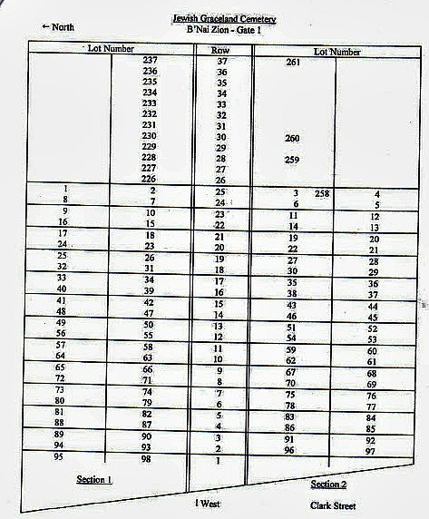
Hebrew
Benevolent Cemeter(ies)
(more details later)

Some bodies were transferred from the Chicago Cemetery while others were re-interred in 'Jewish Graceland'. According to
Guide to Jewish Genealogy in Chicagoland, 150 of those graves were moved from the Chicago City Cemetery to the southwest corner of Belmont and Clark in 1854.

zoomed below
apparent entrance on Clark Street??


Acording to the 'Ten Cemeteries and Wrigely Field' ....


The Cemeteries Bio's

an old township cemetery (Ridgeville/Lake View townships)
when cemeteries were located on church property

'St. Henry church was originally founded in 1851 by a Redemptorist priest, Fr. Henry Fortmann, who served as a non-resident pastor from 1851-1866. Prior to the parish’s founding, Mass was celebrated in the log house of Peter Schmidt located on the Ridge Trail, now known as Ridge Blvd that extends north into Evanston. Although
St. Henry Catholic Church did not have a permanent resident pastor until 1866 - priests from St. Joseph Church in Wilmette and St. Michael parish fulfilled the spiritual needs of their congregates. After the establishment of the Redemptorist Order in Chicago, which was from 1861-1866, the spiritual needs were subsequently attended by the Redemptorist Fathers from St. Michael’s Parish. St. Henry's Church not only served as a place of worship for local inhabitants, but interestingly, the building was later used as its parish rectory. It also served as a hospital for wounded soldiers during the Civil War.


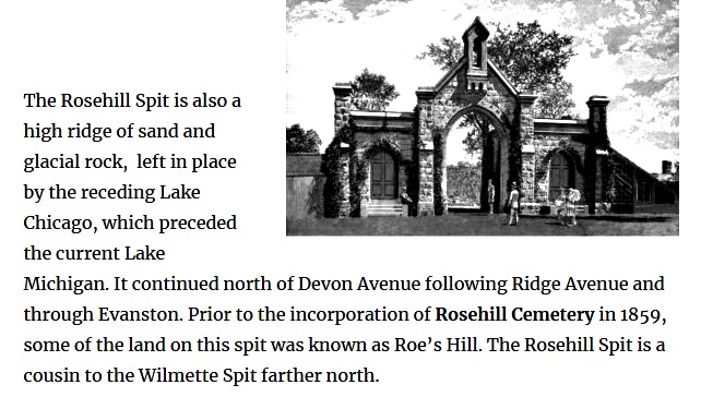
probably named after 'wild white roses'
or
the initial owner of the property Hiram Roe - Roe's Hill


"The projectors of Rose Hill have wisely selected
grounds far enough from the city proper to insure no molestation of the ashes
of the dead in the future, and have chosen grounds high enough for the purposes
intended, and also those susceptible of improvement at a slight expense. They
are of easy access both by rail and drives, which is certainly a desirable
feature."

"Hiram Roe's farm sat atop the highest point in the area, from seventeen to twenty feet above the adjacent prairie on the south and east, and was commonly known as "Roe’s Hill." One of the reasons his land thrived was because, when it rained, it was one of the few farms in the area that didn’t turn into a swamp." Read more ...

images - Description & Dedication of Rosehill
- a reprint publication & part of my collection


A 1862 article
about it

‘In 1864, the remarkable East Gatehouse was built to house the cemetery administration building. The architect was
William W. Boyington; the style was “castellated Gothic.” The East Gatehouse
was placed on the National Register of Historic Places in 1974. The National
Register Report noted: “Examples of castellated Gothic are rare in the Midwest
and this stone structure by Boyington, in being an exceedingly well designed
example of the style, ranks among those few that still exist.” Castellated
Gothic is a style of architecture easily recognized by Chicagoans familiar with
another landmark - the old Water Tower and Pumping Station at Michigan and
Chicago Avenues. Designed by Boyington five years after Rosehill’s gatehouse,
the Water Tower was the only building to survive the Chicago Fire in 1871.
Castellation refers to the parapet design with alienating
indentations and raised stonework reminiscent of a medieval castle. This
Victorian Gothic style was a revival of medieval English architecture and was
used for its picturesque effect. The building material chosen for the gatehouse
was a buff colored limestone that came from the Joliet area. This same stone
masonry construction can be seen in some early Chicago churches and in the
foundations of some of the older homes in Edgewater. Adjacent to the cemetery’s East Gate, and built of the
same stone, once stood Rosehill’s Chicago & Northwestern Railway Station.
It was very important in those days before autos to be allowed easy access to outlying
cemeteries, when periodic cemetery visits were still part of the weekly social
gatherings. Bodies of the rich were transported from the city on special funeral
trains; bodies of the middle, working and indigent classes rode on the baggage
cars of regular trains. The station stop was demolished. All that remains
is a stairway and the elevator once used to lower coffins from track-side to
ground level.


1874 map - Sulzer Reginal Library/Northside Collection
According to the custom of the time, visiting Rosehill in
the second half of the 19th century was a daylong social event. Families and
friends gathered to perform their customary cemetery rituals but picnic and socialize in the park-like landscaped setting.
A trolley car would transported visitors around the grounds.’
A trolley car would transported visitors around the grounds.’
– Edgewater Historical Society in 1995

- Library of Congress

'The Officers and Board of Managers of Rosehill sought to increase Rosehill’s reputation in the years immediately following its creation. Between 1859 and 1860 they published several booklets with information on the cemetery, its dedication, its lot holders. These early lists of lot holders feature names of prominent nineteenth century Chicagoans and were published in an effort to pressure their peers into purchasing lots at Rosehill. The Board of Managers also engaged the public and the [City of Chicago] in conversations about the closing of the Chicago City Cemetery. Primary subjects included availability and price of plots for disinterred remains from that location. In the end, some of the first residents of Rosehill were those moved from the City Cemetery.' - The Civil War and Chicago

2017 photo - Marianne Golk via Original Chicago-Facebook
1891 Sanborn Fire Insurnace Map

map sheet of the entrance neighborhood

with detail view of entrance
.jpg)

.jpg)


photo - Ravenswood-Lake View Community Collection

According to Chicago and Cook County Cemeteries this rural area was set between a mix of low sand hills and
marshland. A creek ran through the area, fed by an underground spring.


by A.T. Andreas
"One of the most beautiful homes for the dead for the country is Rosehill Cemetery, six miles and a half north of the city. The elevation of the ground varies from thirty to forty-feet above Lake Michigan and no other locality within easy distance of the city could have been chosen combining all the advantages of accessibility and good drainage facilities. The grounds which are available for cemetery purposes include about five hundred acres of which two hundred are now platted and improved. From the artesian well which has been sunk to a depth of 2,278 feet and through a system of iron pipes the cemetery is well supplied with water for sprinkling purposes. The beautiful artificial lakes are fed by natural springs and the adjacent grounds are set apart for ornamental purposes. Most of the avenues drives and walks have been macadamized large and handsome green houses and conservatories have been erected and everything possible has been done to keep pace with the growing demands of the wealthy and generous people of Chicago; many of whose friends and kindred are here sleeping their last sleep-the Masons, Odd Fellows, Good Templars, Firemen's Benevolent Association, Typographical Union, St. Andrew's and St George's societies Batteries A and B and Bridge's Battery are among the benevolent and patriotic organizations here represented. The Firemen's Monument was erected at a cost of $15,000 and the beautiful Military Monument erected at the joint expense of the county and the Board of Trade is an imposing ornament."

2012 photos - Leornad Volk via Wikimeida Common


Its members include [Chicago mayor] William B Ogden.
Special Train Service began in 1859
for those who could afford it
1891 Sanborn Fire Insurance Map of the Entrance

with a zoomed view below

Rail entrance per this Daily News Archives 1907 below
entrance to the cemetery from the once called
Chittenden Railway Station. Chittenden was the name of the original community in the area


.jpg)
.jpg)
.jpg)
.jpg)

One of the most unusual buildings in a Chicago area
cemetery is one that consists of just an
elevator. It is a beautiful structure with stained glass windows and could
easily be thought of as a small chapel. Read more from link above.

the station

the old station to the left and then newer one to the right
along the old Chicago Northwestern Milwaukee line
1909 photo - Player with Railroads

2016 view of the stairs that let to the tracks from the street
via Christopher Brandt Forgotten Chicago-Facebook

photo - Raymond Kunst Fine Art Photography
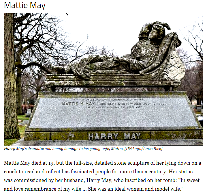
of the infant Marie Jung who was buried in 1863

tribute to the confederate dead
Many of their remains were moved from Chicago Cemetery when Lincoln Park expanded southward from its original location


by Christopher Vernon

built in 1888
1889 photo - Art Institute of Chicago
he one of the many mayors of Chicago buried here

Civil War Vets
Honoring the Fallen

Daily News Archives via Explore Chicago Collection

Daily News Archives via Explore Chicago Collection

Civil War veterans on Dedication Day [Veteran's Day] 1916
Daily News Archives via Explore Chicago Collection

1911 Daily News Archives via Explore Chicago Collection
A Re-Enactment
Robert Krueger 1993-95


A Re-Enactment
Robert Krueger 1993-95


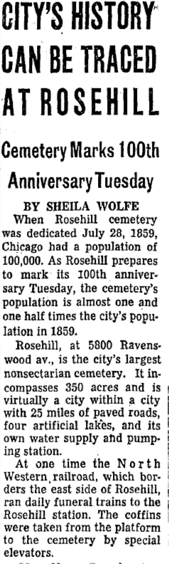
Rosehill celebrated
its 100th in 1959

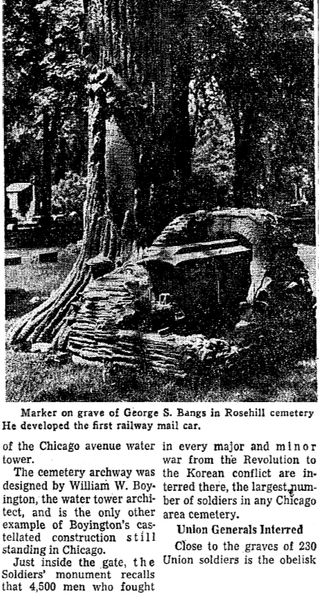
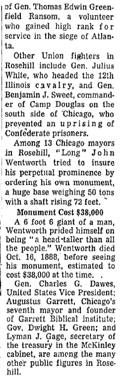

George S. Bangs, inventor of the Railway Post Office Car

He was the most dominant designer of several of
better-known monuments at Rosehill.


John G Shedd Memorial
Kyle Kriegzmann via Original Chicago-Facebook

by Raymond Kunst Fine Art Photography - 2018


Chris Christenson Photography
via Forgotten Chicago-Facebook


Rose Hill Mausoleum & interiors built in 1914


'The original Corporate Charter of the Mt. Sinai Cemetery
Association, under the existing law, would have expired in the year 1889,
twenty years after its issuance, and in the year 1888 the Cemetery Association
re-incorporated under the name of New Mount Sinai Cemetery Association and
received a Perpetual Charter, under which it now operates. The Records of the
New Mount Sinai Cemetery Association indicate that the first burials in the
Cemetery were made in the year 1853.' - from their website. According to the 'Guide to Jewish Cemeteries in Chicago' "The cemetery has an
estimated 25,000 to 30,000 of the Jewish faith. A large number of burials are on the southern side of the cemetery." It is believed that some of the oldest graves in Mt.
Mayriv may have been from the first Jewish cemetery which was Chicago City
Cemetery (in Lincoln Park). 150 graves were moved from the Chicago City
Cemetery to the Southwest corner of Belmont and Clark in 1854. These graves
were supposedly moved again to Mt. Mayriv in 1889. There are a number of
gravestones in F section at Mt Mayriv that are almost undecipherable which may
be these graves. The oldest date that could be read was a death date of 1857 according to Guide to Jewish Cemeteries in Chicago.
The Native American Sight

'During 2018 reclamation project an ancient Native American find was discovered by Phil Millhouse, an archaeologist with the Illinois Archaeological Survey, said he and his colleagues performed
"shovel
tests" on the site earlier this year when they came across fragments of
arrow points, knives, ceramics and possibly a cooking kit. "It turned out
there was a very large prehistoric village on that ridge of sand and gravel
that runs off the lake," he said. The "enormous" site surrounded
by wetlands had been occupied possibly thousands of years before Europeans settled
the area.'

along with a zoomed view of the area that borders Western Avenue
of the restoration & discovery (within the green line)

Autumn 2022
by Gregory Holmes Singleton
Pictures of Chicago/Facebook


video by Robert Loerzei


The Cemeteries
Along Clark Street:
(north & south of Irving Park Road)

The Eternal Silence - Chicago History Museum


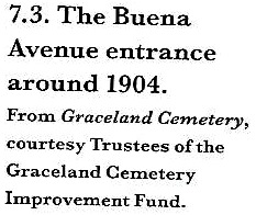
Entrance as of 1908
Graceland Cemetery: A Design History
by Christopher Vernon
by Christopher Vernon
Entrance on Graceland Avenue (Irving Park Road)
in 1891
1891 Sanborn Fire Insurance Map

from Library of Congress

1887 Rascher's Atlas Maps
The property once was located on both sides of Clark Street

This map below is east of the previous map

 both photos - Chicago History Museum


 "It [the cemetery] is reached by horsecars or by the (broad drive??) along the lakeshore and through the park. Before long also it is anticipated that trains will be running directly to it over the Chicago & Evanston [rail] line. A station house has already been constructed by the company which is really an architectural ornament containing besides public accommodations the neat office of the cemetery. The spacious grounds which are formed by a series of ridges have a complete system of drainage the main sewer having been constructed to Lake Michigan at a cost of $10,000. Living springs supply the artificial gems of water and by means of a steam pump water is carried through a network of iron pipes to all parts of the ground. Thus it is that even during the most parching the wide and beautiful lawns are always cool and green. The air of freedom and the unobstructed view of the magnificent grounds are to be preserved far as possible by excluding all lot enclosures or boundaries by restricting the height of the monuments to a few inches and by limiting the of large monuments. Conspicuous among the architectural beauties of the place may be mentioned the and yet simple monument of W.M. Hoyt, just completed the gothic mausoleum of H.H. Taylor, fine obelisk of Washington Smith, the stately column of T.M. Avery, the corinthian column statue of I.B. Shipman, the tasteful monuments E.H. Haddock, CB Blair, William Blair, Whitbeck, WD Fuller, and the massive tomb William J Wilson. Many of Chicago's historical are here recorded [here] William B Ogden, George Manierre, Mahlon D Ogden, Jonathan Burr, John H Kinzie, Norman B Judd, Justin Butterfield, Alexander Fullerton, Walter L Newberry, WF Coolbaugh, Eli B Williams, and John Calhoun. Up to the present thirty seven thousand interments have been made Graceland Cemetery."


 Graceland Cemetery: A Design History
by Christopher Vernon


 1872 receipt - Ebay
 1874 grave receipt - Calumet412 via Lance Grey

 document below from 1867 via Ebay

The Chicago & Evanston RR borders the cemetery


map below


An Historical Account
as of 1884
"The founding of Graceland Cemetery was in pursuance of the general demand for extramural interments. In 1860 Thomas B. Bryan purchased the eighty-six acres which now comprise the principal portion of the grounds. By act of Legislature passed February 22, 1861 Mr Bryan with William B Ogden, Edwin H Sheldon, Sidney Sawyer, George Healy, and others incorporated The Graceland Cemetery Company. The act granted to the company the privilege of acquiring a tract of land to be used for cemetery purposes not to exceed five hundred acres. The act also exempted the lots from taxation execution or attachment and provided that none of the cemetery land should be condemned for 'right of way'.
Mr Bryan was chosen president of the board and continued is that position until 1865. James L Reynolds then serve three years and Mr Bryan again became president remaining in office from 1868 to 1878. Thomas b Patterson was the incumbent from 1878 to 1881 when Bryan Lathrop at present in office became president of the company. The present officers of the company are Bryan Lathrop president and treasurer, Thomas E Patterson secretary, JH Lathrop, Thomas E Patterson, Bryan Lathrop, CW Litchfield, and Owen Aldis, board of managers. In 1861 the company purchased forty-five acres of the original plat in 1864 thirty-five acres to the east and in 1867 one hundred and nine acres north. Thus by the latter year they had purchased two hundred and seventy five acres of land.The final limits of Cemetery were thereby fixed. Graceland Cemetery is situated near the lakeshore northeast of Belle Plaine [railroad] station and about two miles north of Lincoln Park, [the park]."
The park at his time extended only to Diversey Parkway.

Greeta Hootman via Pictures of Chicago-Facebook
25 year old fireman who died in 1857 df

image - Thomas Campone Photography
the landscape view in 1879
with Community of Ravenswood as its neighbor
map page - Graceland Cemetery: A Design History
by Christopher Vernon
by Christopher Vernon

once owned proprerty west of Clark Street as of 1887
1887 Rascher Atlas Map

zoomed below

some property was donated for the Lake View High School
*lower left of map*
below the eastern part of the cemetery property
Stella = Seminary Avenue


postcard - Ebay

by Christopher Vernon
Sample of Cemetery Transactions


the landscape in 1884 east of Clark Street


Some of the Monuments:
The letters in this map above indicated the sections of the cemetery
from Graceland Cemetery: a design history by Christopher Vernon

Some of the Monuments:
1901 photo - Art Institute of Chicago


1909 photos - Art Institute of Chicago

"There are many legends surrounding the eerie obelisk, arguably the most famous being that upon looking into its eyes a person could see the nature of their own death" according to an online article called 'Hidden Chicago: Eternal Silence'

Greeta Hootmand via Picture of Chicago-Facebook
and below by Raymond Kunst - Fine Art Photography

Sullivan, Louis H., Tomb

1924 photo above - Art Institute of Chicago

photo - Richard Nickel


 zoomed photo - Art Institute of Chicago


1893 sectional photo - Art Institute of Chicago


 Lake View Township's Old Town Hall


The Dedication of
Graceland Cemetery
1860 Chicago Daily News
A Dr. Conrad Sulzer Contribution
Conrad Sulzer, noted as chief architects of the Township of Lake View owned property along the new cemetery & donated much of his original property to the Graceland Cemetery Company
Note: Green Bay Road=Clark Street
Sulzer Street=Montrose Avenue
First white settler is incorrect in this section
- Graceland Cemetery: A Design History by Christopher Vernon
Ravenswood-Lake View Community Collection
Lake View Township
vs Graceland Cemetery
1869-79
The Township of Lake View had some interesting discussions about their expansion beyond their initial land purchase. The conflict involved lost taxation to the township treasury
images below - Graceland Cemetery: ...
A Design History by Christopher Vernon
The Conflict Part I
The Conflict Part II


The Gate Lock of Ryerson Tomb
via Joey Korom, Pictures of Chicago-Facebook

And Then in 1879 the Final Expansion


1894 Sanborn Fire Insurance Map
of the entrance

1905 Sanborn Fire Insurance Map
of the entrance

The Original Sections Views
& the Avenues Within:
Graceland Cemetery:
A Design History by Christopher Vernon
1904 photos


Woodlawn Avenue below


The reference book used for the photos above
A Design History by Christopher Vernon
This book is part of my collection


Maintenance Booklet
for the Lot Owner
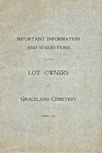
This booklet is part of my collection


Some of the Residents


All photos + captions were submitted by TJ Casey to Forgotten Chicago-Facebook in 2016.
I included the links
The Entrance to Henry Burnham

from Chicago Architectual Center

photography by Rick Drew

photography by TJ Casey


Carrie Eliza Mausoleum

Photography by TJ Casey
photography by Richard Nickel below


Photography
by Alfonso Ramos


Photography


"Ernie is buried among many of Chicago’s most well-known citizens, for better and sometimes for worse. A few feet away lies Ruth Page, well-known ballerina and choreographer whose Nutcracker was performed every holiday season for decades at the Arie Crown Theater in McCormick Place" - Waiting4Cubs


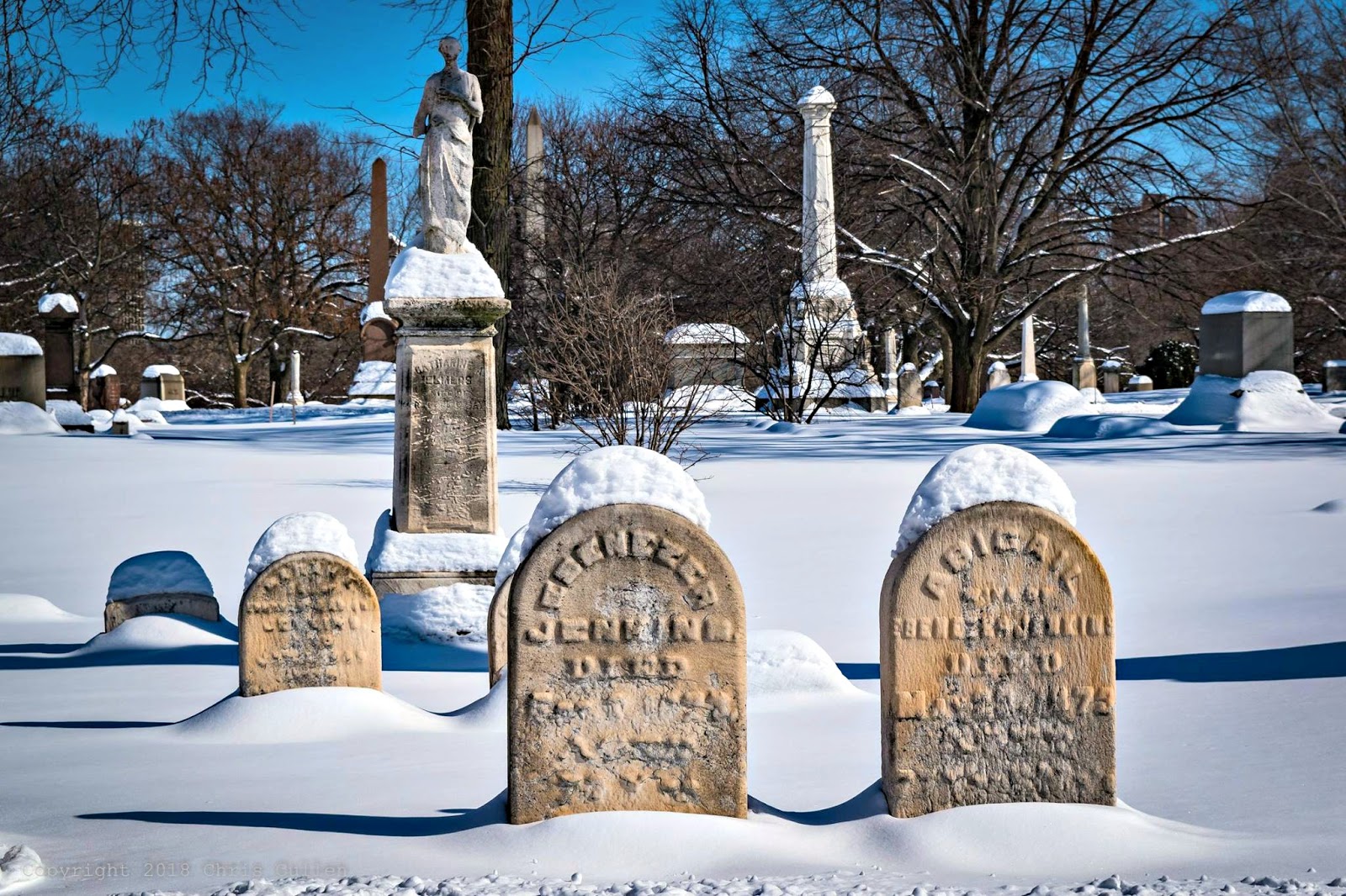
Winter in Graceland
by Chris Cullen
via Pictures of Chicago-Facebook


To Be Lost
and Found


Karl and Anna are buried in graves marked by small, flat,
rectangle-shaped slabs with nothing but their names and birth and death dates
for an inscription. They lie in the southeast section of Graceland, with a
cemetery road marking one boundary of the section and a wall where Chicago’s
red line elevated train runs along marking another boundary. My
great-grandfather lies right up against this wall, right at the cemetery’s
perimeter. Which means to visit his grave, you’ll inevitably have to endure the
roar and rattle of the el passing by at some point. The el tracks are so close,
the train shakes the wall. My great-grandmother lies a few rows in from the
wall, near a tree, but still close enough that her grave bears the train rumble
night and day too. Read more of this interesting article

Autumn Colors
by Wayne Johnson 2022


and photography by Joe Koecher 2022


The Growing Population

photos from Graceland Cemetery


(Latin)

St. Bonfacius German Catholic Cemetery known currently
as Boniface Cemetery was the first of the German-American owned cemetery that contains the burials of the successful builders
of the then German-American community


1887 Rascher Atlas

Lawrence Avenue not a through street at this time


According to Chicago and Cook County Cemeteries this cemetery was named after Saint Boniface, a scholar,
teacher, & missionary who for 36 years served the so-called pagan tribes of fragmented Germany. Saint Boniface was the “Apostle of Germany.” The cemetery underwent extensive renovation in the
1960’s, with the old gate removed to permit better vehicle passage. This cemetery once located in rural Lake View Township found itself surrounded by the 20th century city with no additional
land available for growth.
According to an online source 'Find a Grave' the first internment at St. Boniface was for a 9-day old infant named Marie Jung. Her burial took place on October 19, 1863. Currently, there have been 90,501 burials at St. Boniface. While this cemetery no longer has any grave space available for purchase but current burials are still administered for persons who hold a deed to an unused plot.
below map - Chicago Cook County Cemeteries


text - Chicago, The Garden City by Andreas Simon 1893


When German was the dominant language in the area ...

and when Lake View was a township/city 
photos - HMbd
In memory of the heroic Germans who took part in the defense of their new fatherland in the American Civil War
unveiled May 30 1887
unveiled May 30 1887
Widow dies at husband's grave 1896

page 2


photo - Raymond Kunst Fine Art Photography
Also explore more photos from Explore Chicago Collection
Before the Germans


The Township Cemeteries
South
of Irving Park Road:
1887 Rascher Atlas


'This cemetery was founded in 1859 and originally called The First German Lutheran or The Evangelical Lutheran Cemetery. The German Lutheran Cemetery was incorporated in 1912. On October 19, 1919, it was renamed Wunder’s Cemetery Association to honor the Rev. Heinrich Wunder, pastor of First Saint Paul's Evangelical Lutheran Church.' - per their website

Pastor Heinrick Wunder
photo - St Paul Evangelical Lutheran Church


1887 Sanborn Fire Insurance Map of the area

zoomed below

sectional map below
as Wunder's

from their website

photo - Klien Photographic

- Chicago, The Garden City by Andreas Simon 1893
photos below - Gravely Speaking


The Cemeteries
in One:

Known as ...
and its' latest Renewal


Chris Cullen Photography
at Hebrew Benevolent section of this cemetery

2016 photo - Raymond Kunst Fine Art Photography

"These are 2014 photos of the north section of Jewish
Graceland. All of these were taken from the edge of the area. I didn’t want to enter and walk around because the ground
is so covered with weeds and plant life that it was nearly impossible to see
what you were walking on, and I didn’t want to end up stepping on top of
various headstones that were hidden underneath. I’m planning to take a trip
back later this fall when most of the leaves are gone and it will hopefully be
easier to navigate." - Coffee and Attitude

Coffee and Attitude 1

Coffee and Attitude 2

Coffee and Attitude 3 below

'The Hebrew Benevolent Society was founded in 1851. Its founders included David Witkowsky, an early president of Congregation B'nai Sholom (the second oldest synagogue in Chicago, now a part of K.A.M. Isaiah Israel Congregation). One of the society's main purposes was to create a Jewish burial ground. There already was a similar group, the Jewish Burial Ground Society, which operated a cemetery in what is now Lincoln Park, [the park]. This Lincoln Park cemetery, which was the first Jewish cemetery, soon had to be moved to another site because of its proximity to Lake Michigan. Jewish Graceland would become the second Jewish cemetery in Chicago.' - United Jewish Fund of Chicago
Chicago, The Garden City
from historian Andreas Simon 1893


Vandals Strike in 1985
(click on article to enlarge)


Veronica Drake via Forgotten Chicago-Facebook
photo below - Raymond Kunst Fine Art Photography


for this article


GATE 2
 GATE 3
 GATE 4


photo below - Raymond Kunst Fine Art Photography

GATE 2


Chris Cullen
Photography 2018


In the
Olden Days ...

article via Atlas Obcsura

"During the 19th century, and especially in its later years, snacking in cemeteries happened across the United States. It wasn’t just apple-munching alongside the winding avenues of graveyards. Since many municipalities still lacked proper recreational areas, many people had full-blown picnics in their local cemeteries.
The tombstone-laden fields were then to modern-day public parks."

Follow me to my next posted called
Important Note:
These posts are exclusively used for educational purposes. I do not wish to gain monetary profit from this blog nor should anyone else without permission for the original source - thanks!