
CHICAGO &ITS SUBURBSby EVERETT CHAMBERLIN1873(sixteen years before the annexation of the City of Lake View - former township, to the City of Chicago)Lake View: page 343This is a large township, extending north from the [Chicago] City limits [[Church) Devon Avenue], a distance of over 5 ½ miles, and from the lakeshore west from two to three miles. The south boundary [Fullerton Avenue] is but two and a half miles from Clark Street Bridge. Its natural features are among the best in the vicinity of Chicago. The wooded section, in the southern edge of which Lincoln Park [the park] is situated, extends along the lakeshore, far to the north, and many miles beyond the northern limits of Lake View. This gives the place the very desirable advantage of grove lots throughout its length and breadth and affords many very pretty residential sites which have been largely taken advantage of by citizens of Chicago whose means enabled them to enclose large lots and build handsome homes upon them. The place is thickly settled as a consequence of these advantages, and its nearness to business centers in Chicago. The area of the township is about ten square miles. The lands in Lake View attracted early attention. The settlement dates back over a period of twenty years, and many of the lots having, during this long stretch of years, been subjected to constant improvement, the place bears something of the appearance of the older suburbs about the cities in the East. Viewed from the observatory of the new United States Marine [veteren] Hospital, the whole village resembles a beautiful park. The government of the township (incorporated in 1865) [established in 1857] is in the hands of a Board of Trustees, who have control of thoroughfares, bridges, public improvements, buildings, the police force, and generally of all matters usually subjected to municipal rule. The routes of approach to Lake View from the city are as follows : One line of horsecars leave Clark Street Bridge every twelve minutes, running north on North Clark Street to Diversey Street one-half mile within the limits of the place and connecting there with a Dummy [Engine Railroad] to Graceland Avenue [Irving Park Road], which runs once an hour. This trip occupies fifty minutes. A second line of horse-cars leave Clark Street Bridge at like intervals, and run on Clark Street to Lincoln Avenue — opposite the principal entrance to Lincoln Park [the park] — and then on Lincoln Avenue in a northwest direction, and reaching the southern limit of Lake View at Fullerton Avenue, one mile west from the lakeshore. The Milwaukee branch of the Chicago and Northwestern Railroad runs through the suburb north and south with a daily service of twelve trains each way. In addition to the second track now being laid on this road, there are now under consideration two other projects looking to the development of the Lake View by new railroads, one to run out of Chicago on Sheffield Avenue [will] ensure a prosperous future. The natural growth made tree planting unnecessary, and the high and sloping nature of the ground, with its subsoil of gravel or sand, provided so much natural drainage that this adjunctive advantage could not assume the degree of importance attaching to it in many other suburbs. Recently, a general system of improvements have been inaugurated. A number of double ring brick sewers are ordered. Roadbeds of cinder and gravel [have been] ordered on a number of other thoroughfares.
The Lake Shore Drive is
one of the finest improvements in or about Chicago, and when completed will
afford a carriage-way 200 feet wide, extending from Indiana Street [in Chicago] to Evanston [Township] —
twelve miles. The whole surface will be graveled and curbed as hard and level
as a floor.


page 709
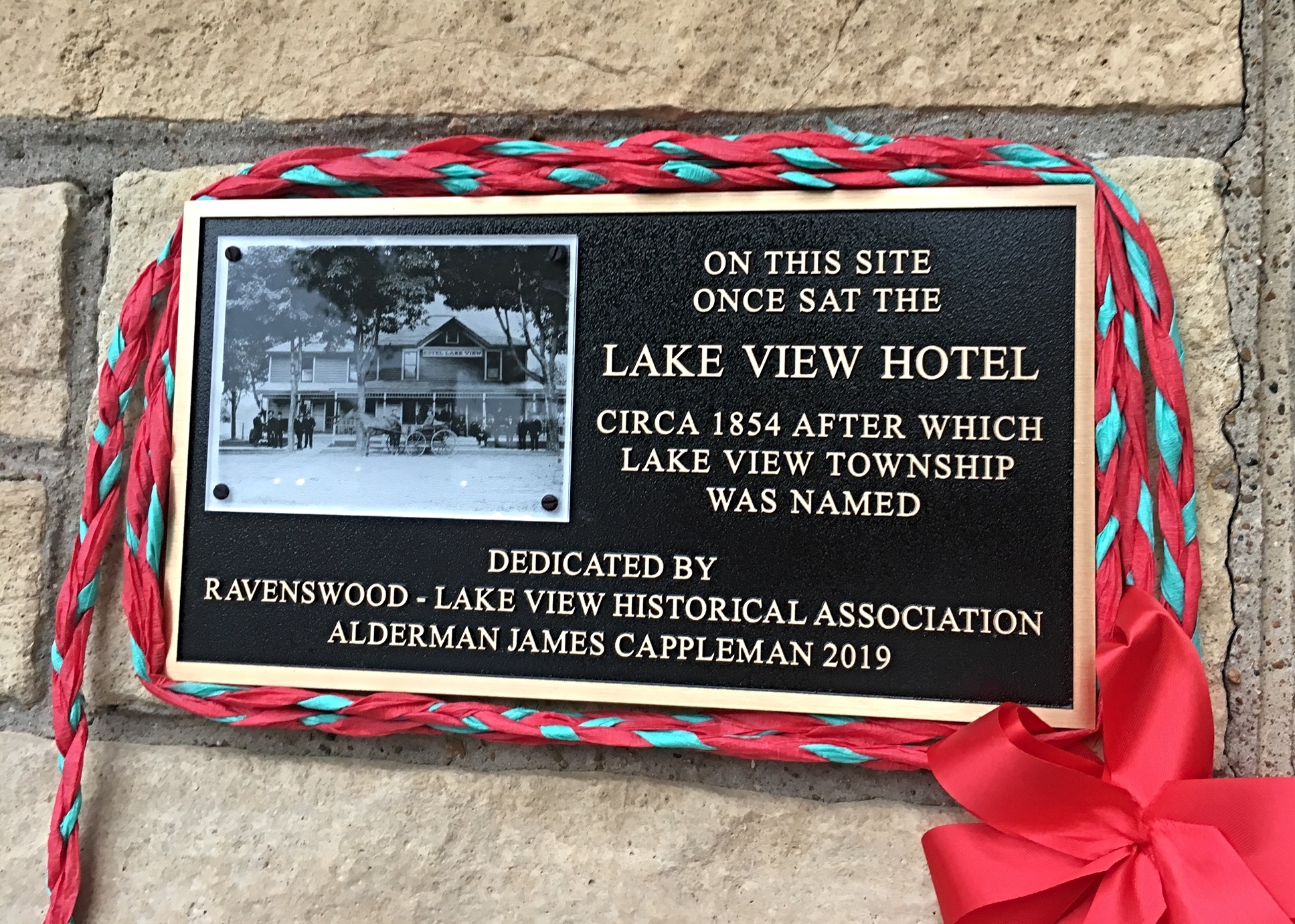
When a number of citizens of Andersonville and vicinity assembled at the school house which had lately been completed to make arrangements for holding the township election of Lake View they had unconsciously perhaps commenced to make history for the future. [Mr.] I.S. Shippy was moderator of that meeting and John Mauritzen the clerk. It was resolved that the be held April 7, 1857 and that $175 be raised for expenses. The old school house just mentioned stands [as of 1884] at the extreme northeasterly corner of the subdivision called Andersonville. There was something a contest between Robert Edson and S.H. Kerfoot candidates for the office of Supervisor and both them filed their certificates of election but Mr. Edson was finally successful. Sixty four votes were cast Supervisor Edson feeling no doubt elevated at his fortune proceeded to purchase the first record- book of Lake View. The exact time when Mr Edson reached down into his own pocket to accomplish this matter is fixed by entry which still appears on the fly leaf of the volume and which reads:
'Bought June 16, 1857 by Robert Edson Supervisor of Lake View Township Price $2.50 dedicated to the Township Clerk of Lake View Township'
The entire ticket elected in April 1857 was as follows: Robert Edson Supervisor, Conrad Sulzer Assessor, Nicholas Kranz Collector, John Mauritzen Township Clerk, Isaac C. Shippey Justice of the Peace, Lewis A. Brown, Jacob Wolf, and Francis Baer Commissioners of Highways, John Rees Constable, John Bugner Overseer of the Poor.
The Commissioners of Highways at once held a meeting and divided the town into two districts No 1 comprising all the territory from the city limits north to Albert Street (Graceland Avenue) and No 2 everything between Graceland Avenue (Irving Park Road) and the northern line of the township [Church Road (Devon Avenue)]. The next year James H Rees was elected Supervisor and continued to hold that position until after the town was incorporated [in 1865].




2024
Excellent video. I am a Lakeview East resident and I absolutely love it. it feels like two completely different worlds though Lakeview East and West. Once you get about a block west of the stadium feels much more residential and suburban. Lakeview East feels like more of a vibrant city neighborhood. that stretch of Broadway from Addison to Diveresy is probably my favorite street in Chicago. it’s also kind of jarring how desolate it gets on Clark and Halsted between Belmont and Diversey. Hopefully they can livin it up a bit more.
@chuyiwen9875
2024
We just moved here. It’s being like a dream! Endless choices of restaurants within walking distance, day to day life needs like groceries, tailors, leather repairs, locksmith, haircut, plant shops and comedy shows are all walkable.


Celery: Miracle food meets Lake Michigan
The city’s remaining link to its once-vast celery industry may be the celery salt finish on Chicago-style hot dogs. But 150 years ago the city was at the heart of a celery craze that had spread across the United States. “Celery was huge, kind of like kale today,” says food historian Bruce Kraig. “It was this big 19th-century food fad because people thought it had miraculous health properties. I think it’s because it was so fibrous and you had to chew it so long.”
Folks ate celery at restaurants, used special crystal celery vases and consumed celery pills and tonics like Paine’s Celery Compound advertised as “a positive cure for dyspepsia, biliousness, liver complaint, neuralgia, rheumatism, and kidney troubles.”
So, Chicago — with its celery-friendly sandy soil, abundant fresh water and national rail transportation — was a perfect spot to grow and export the vegetable to an often dyspeptic nation. Plus, celery could be harvested as late as January during a mild winter, so long as it was packed in sand or soil. Hundreds of Chicago immigrant farmers grew the vegetable on what became the city’s North Side. According to 19th century Chicago horticulturist Edgar Sanders, Lakeview Township soil was “black,” “boggy” and “plentiful mixed with sand.” He added: “There is no land which can compete with such as this for celery culture.” By the end of the century, though, other lands stole Chicago’s celery crown. Kalamazoo, Michigan, had cheaper land, as did California, which had also had an advantage of a year-round growing season. Farmers in what became the Edgewater neighborhood grew celery well into the 20th century. In an essay for the Edgewater Historical Society, Carl Helbig recalls that his father grew it in manure-filled hotbeds over “black and sandy” soil as late as the 1930s. But he admits the crop was already well on the way out. “I venture to say that my father was the last one to grow celery in that large a volume in Edgewater,” he wrote.
The Ecomonic Driver at the Time postcard above with edit - Etsy

Pickles: Agriculture Meets Industry
In the late 1880’s Chicago was home to no fewer than three nationally famous pickle brands: Budlong, Squire Dingee and Claussen. These operations thrived in Chicago for several reasons: European pickle know-how; a robust local salt processing industry; rail and other transportation options; and — early on, at least — productive pickle farms. In 1903, the Chicago Tribune reported that there were “12,000 bushels of onions and cucumbers picked and sacked in a day” during the busy season on North Side farms that stretched from Bowmanville (around Foster and Western) to Evanston. Lyman Budlong became an industry leader shortly after he arrived in Chicago. In 1859 he established a pickling business near Foster and Lincoln avenues in the middle of his Budlong Pickle Farm, which, by some accounts, stretched across 700 acres. By the turn of the century, though, a pickle blight forced pickle-makers to import cucumbers from outlying farms. Still, according to Eleanor Atkinson’s 1912 The Story of Chicago and National Development, Budlong’s farm kept growing other crops. “The farm is occupied profitably with raising every kind of garden truck [vegetable] which can be persuaded to grow, most of it going to city tables, but some shipped to distant points in the U.S. and Canada. This farm gives employment to about 2,000 labors in the busy season and affords healthful and remunerative employment to those who toil in the city during the winter and can get out to the pickle farm for air and ready money when the work was slack in town and when the citisw stifling with dust and heat in its crowded quarters.” But such a large farm couldn’t last forever in the expanding city. By the 1920’s the Budlong Farm had become a golf course and was later subdivided into a residential area called Budlong Woods. Squire Dingee [& Company] also moved its operations out of Bowmanville to Lincoln Park and eventually merged with Beatrice Foods.


Even though Chicago had the fertile soil and infrastructure needed for farming, the city lacked year-round warmth. So local truck farmers (those who “trucked” produce to Chicago’s central markets) turned to greenhouses to supply lettuce, tomatoes, peas and other veggies in the off season. It was a popular European technology that could be fueled cheaply by Chicago’s abundant coal supply. “Illinois ranked first among other states in area covered by glasshouses. … A large percentage of these [were] in neighborhoods of Chicago, and several firms have each over a million square feet of glass,” Cathy Jean Maloney writes in her book Chicago Gardens.
In 1870 the John C. Moninger Company was founded in Chicago and would become one of the nation’s biggest greenhouse manufacturers. Immigrants from Luxembourg ran many of the greenhouses on Chicago’s far North Side and its northern suburbs.
Thousands of Luxembourgers settled around Ridge and Church Roads (Devon Avenue), where the ground was higher and good for planting outdoors as well. In the Encyclopedia of Chicago, author Kathleen Neils Conzen writes that there were “Perhaps a hundred greenhouse clusters stretched from Rogers Park northwest through West Ridge, Niles Center, and Des Plaines, most in Luxembourg hands by 1919 when their growers’ association numbered some 1,200 families.”
Jim Leider of Leider Horticulture is a third-generation Chicago grower. But he says his tropical plant business today is different from his Luxembourgish grandfather’s turn-of-the-century truck farm with a greenhouse in Rogers Park. “My grandfather tells a story that he had to get up early, early in the morning to take his produce down to South Water Market,” Leider says. “He’d load it up on the horse and buggy, sell it there, and come back home. He said that he was so tired by the time he was going back to Rogers Park that he would fall asleep, but the horse knew the way home.”
Chicago’s greenhouse culture wouldn’t last forever. Once refrigerated trains could efficiently import cheaper produce from across the country, there was less need to grow off-season produce locally. “Plus, the cost to heat them in the winter was getting prohibitive,” Leider says, “and rising real estate values in the city made it more attractive for people to just sell them.”
Flowers: Infrastructure and technology allow Chicago to bloom
It may be hard to believe, but for several decades Chicago was the nation’s flower capital. One of the earliest citizens to grow commercial flowers, especially roses, was Dr. John A Kennicott. In 1837, he settled in what is now the Village of Glenview once called The Grove. In 1881 his descendants built a wholesale business that served flower farms across the city and suburbs. Great-great-grandson Harrison “Red” Kennicott says Chicago was the nation’s floral capital for some familiar reasons. “For one, Chicago was a railroad hub and that was the main means of getting flowers to other localities,” he says. “There was also a very inexpensive local source of coal to fuel the greenhouses. And there was also a plentiful supply of labor to work in the greenhouses.”
Like a lot of Chicago’s flower growers, Joseph Budlong (the brother of pickle-maker Lyman Budlong) started his Bowmanville greenhouses to grow vegetables, but when their profitability declined, he transitioned to flowers exclusively by 1880 with the Budlong Nursery around Lincoln and Foster Avenues. A 1907 description in American Florist magazine estimated that the Budlong Nursery housed 30,000 grafted rose plants (mostly American Beauty and Richmond) in its dozens of glass houses.
In the early part of the 20th century flower greenhouses covered swaths of the North Side and northern suburbs. And there, Kennicott says, growers produced hundreds of thousands of roses and carnations that would find their way to tables, weddings and graves all over the country. But by the 1950’s, affordable and reliable air shipping shifted the center of flower production to California and later South America. Block says remnants of Chicago’s greenhouse past linger in legacy flower centers along the Chicago border; they include Clesen Wholesale in Evanston and Urhausen Greenhouses in the village of Lincolnwood. Perhaps the oldest legacy of Chicago’s floral past can be seen in the annual Chicago Flower and Garden show, which started in 1847 as the Chicago Horticultural Society’s “Exhibition of Fruits and Flowers.”
Fields of produce: Dutch and German truck farms feed the masses
In the mid 1800’s, rural immigrant farmers from Holland, Germany, Sweden, and Luxembourg flocked to areas just outside the city limits to establish truck farms. Geographer Daniel Block notes that a legacy of this Dutch farming hung around the Chicago area well into the 21st century; the DeJong Brothers spinach farm in Lansing didn’t close until 2015.
Another legacy of Chicago truck farming remains on the North Side to this day. The Meinke Garden Center stands where Henry Meinke’s grandfather started a farm on Chicago’s border with Niles on Touhy Avenue in the 1870’s. “Back when I was a boy, we grew beets, carrots, onions, and tomatoes, and took them down to the South Water Market,” says the 91-year-old third-generation farmer. “Later, we started a farm stand on the property here in 1929.” Before World War II, Meinke says, “this whole area was German and Luxembourger farmers,” and they were growing for a clientele with largely European roots. But today, Meinke says, his family’s garden center caters to a new wave of Chicago immigrants.
“We sell a lot of hot peppers and bitter melon plants because we have a diverse group of customers these days,” he says. “One new plant we are raising this year is a moringa tree. It’s native to India, grows quite rapidly, and is supposed to be very nutritious. … You see, people, they like to have the plants that they are used to from their home country.”


